20060821 Amalik Bay/Geographic Harbor Trip Part 1 Introduction and Setting
INTRODUCTION
Most coastal users either fish, view bears, or both. The anglers can be nearly impossible for the National Park Service to contact since the waters are the jurisdiction of the State of Alaska and not the federal government. Contact with bear viewers who remain in vessels likewise can be politically sensitive. Should bear viewers come on shore above the mean high tide line, they are fair game. That is where the Park Service has uncontested management authority.
The Park has devised a lengthy survey to gather information from coastal users. Interpreters like myself spend a week at a time in known bear viewing locations distributing surveys. August 19, 2006 three colleagues and I returned from a most amazing week camping beside Amalik Bay and distributing surveys in Geographic Harbor, an arm of Amalik Bay where bears gather for an August pink salmon run.
Most of the next several blog entries will cover our experiences at Amalik/Geographic. Expect topics like personnel, accommodations, weather, tides, food, hygiene and the privy, bears and other wildlife, the survey, the daily routine, our experience aboard a cruise ship, flights into and out of Amalik Bay, and whatever else comes to mind. Today you will learn a bit about the setting of this adventure.
Part 1: THE SETTING
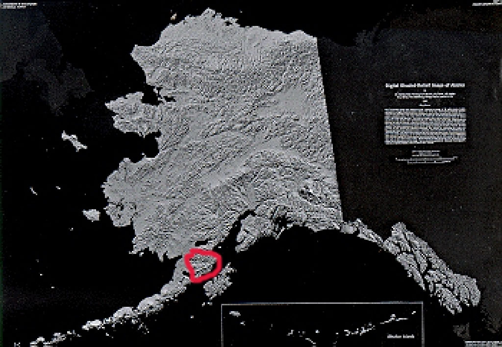 The Aleutian Range of mountains arcs from southern Alaska toward Asia much the same way as the islands of the Florida Keys arc toward the Gulf of Mexico from the southern tip of the Florida peninsula. The westward two-thirds to three-quarters of the Aleutian Range occur on an island chain of the same name. The eastward balance connects to the mainland and makes up much of the land known as the Alaska Peninsula. The head of the Alaska Peninsula is where you will find Katmai National Park and Preserve.
To the west of the very roughly triangular Park and just a few miles beyond the Park boundary, the Alaska Peninsula borders the Bering Sea at Bristol Bay. The Lake Iliamna watershed forms most of the northern Park limit, while the Pacific Ocean defines the southwest border of the Park, more specifically an oceanic feature called Shelikof Strait. Across Shelikof Strait about twenty miles sits Kodiak Island.
 Most of the 497 miles of convoluted Katmai coastline face the Shelikof Strait. Amalik Bay and Geographic Harbor comprise a few of those miles. Really one bay, Amalik would be the outer bay and Geographic Harbor the inner, fingerlike bay. Numerous irregularly shaped islands punctuate the bay.
 Just as the mountains generally rise sharply from the bay and harbor, the waters of the bay quickly become deep as you move from shore. No true trees can be seen on the mountains or their shoulders, though shrub thickets abound interspersed with grasses, sedges, and forbs. Above the shrub line and below the bare mountaintops lies an exposed band of what appears to be snow but is pumice. This volcanic product constantly reminds us of the great 1912 eruption of Novarupta, the largest on earth during the 20th century, and of the presence of numerous active volcanoes less than twenty miles distant.
 Shrunk to insignificance by the grandeur of the surrounding land- and seascapes, a tiny ranger cabin situates in a cove of the outer bay about forty yards above the high tide line.
  I was lucky enough to be among four rangers sharing this little bit of paradise the third week of August 2006.
posted by Tim at 12:19 PM
![]()
![]()
.jpg)

0 Comments:
Post a Comment
<< Home